Portland's Great Fire of 1866

Map of Fire's Extent

Image from Maine Historical Society.

The fire began on the afternoon of July 4th, 1866 as Portlanders celebrated Independence Day. Accidentally ignited, the fire was likely started by a firecracker or a cigar. It began on Commercial Street near the present-day location of Hobson’s Landing (until it closed in 2016, the Rufus Deering Lumber Yard) and spread to John Bundy Brown’s sugarhouse on Maple Street.

The intense heat of the fire melted the building's steel shutters and galvanized iron roof, sending out a thick black smoke over the city. Powered by strong winds, the fire swept diagonally across the city through the Old Port and the India Street neighborhood to Munjoy Hill where, aided by the tireless efforts of the City's firefighters, it burned itself out early on July 5th. Portland’s Great Fire predated the Great Chicago Fire and at the time was the largest fire ever in an American city.

The fire destroyed the new City Hall, the Customs House, the Post Office, all the city's banks, and many hotels, shops, and offices. Several churches were destroyed by the flames, including the Cathedral of the Immaculate Conception, which was still under construction. Of the 1,800 buildings destroyed by the fire, 1,200 were residences. These were home to 10,000 of Portland's citizens, leaving both wealthy and poor homeless.

Photographs by J.P. Soule, taken on July 12-14, 1866

In the Aftermath, Relief for Portland's Sufferers

Portland's leaders issued a call for help. The Federal Government shipped 1,500 tents to the city, which were set up in a makeshift tent city below the Portland Observatory on Munjoy Hill. The City of Boston sent five train cars of food that was served from a soup kitchen set up in the old City Hall in Monument Square. Train loads of blankets, clothing and other goods arrived from Sherbrooke, Montreal, and Ottawa in Canada, and from other New England states.  As word spread of the extents of the disaster, donations arrived from all over the United States. Letters acknowledging many of these donations were saved by the city and are now available online at the Portland Public Library

Like a Phoenix the City Arises from the Ashes

Portland was almost completely rebuilt in the following two years, giving the city its characteristic brick, Victorian architecture. Workers poured in to assist in clearing the debris and rebuilding the city. Architects from Boston, New York, and Canada opened offices in Portland to assist in rebuilding efforts. Most of the buildings constructed after the fire were built in one of the two popular styles of the time period: the Italianate Style and the closely related Second Empire Style. Most commercial and multi-family buildings were built of brick and granite, to lessen the chance of fire. The Old Port was rebuilt as a mostly commercial area, while new residential construction occurred on Munjoy Hill and in new suburbs in Deering. To serve as a fire break between the new commercial area and new residential construction on Munjoy Hill, the city purchased the land bounded by Pearl, Franklin, Federal, and Congress Street for a city park. First named Phoenix Park, it was renamed the following year as Lincoln Park.

To ensure a reliable water supply, the Portland Water Company, later known as the Portland Water District, began piping water into the city from Sebago Lake in 1869. A large reservoir on Bramhall Hill was constructed for water storage in 1868, with a second large reservoir built on Munjoy Hill in 1888. In the neighborhoods affected by the fire, new fire stations were built, like the one on India Street in 1868.

Learn more about the buildings that survived the Great Fire.


Learn more about Portland’s Great Fire:

Portland's Greatest Conflagration: The 1866 Fire Disaster by Michael Daicy and Don Whitney

The Night the Sky Turned Red: The Story of the Great Portland Maine Fire of July 4th 1866, as Told by Those That Lived Through It by Allan M. Levinsky and Earle G. Shettleworth, Jr

The Day Portland Burned: July 4, 1866, an anniversary edition of the Evening Express by Earle G. Shettleworth, Jr.

Account of the Great Conflagration by John Neal


Portland's Historic Public Schools

The City of Portland has been a educational leader in Maine for over a century. Beginning with the State's first public high school, Portland has led the state with innovative programs for adult learners, manual training, and school design. Although some children still attend classes in a historic school, many neighborhood schools have been consolidated in newer buildings. Some of the former school buildings have found a new use, while sadly other buildings were demolished. Landmarks has collected the following information on historic Portland school buildings with help from a list recently compiled by the School Department and resources in our collection. 


Portland High School, Portland Past and Present

Portland High School, Portland Past and Present

Portland High School, Cumberland Avenue

The earliest portion of Portland High School was built 1862-1863. It was significantly expanded by architects Miller and Mayo 1917-1919 to accommodate Portland's increasing student population, as enrollment at Portland High School doubled between 1890-1920. The oldest section of the school pictured at the left became the middle wing of the new E-shaped school that extended between Elm and Chestnut Street on Cumberland Avenue. In 1920, the middle wing was significantly damaged by fire and then rebuilt to meet the standards the adjacent 1919 school addition. It was added to the National Register of Historic Places in 1984.

 
Deering High_Todd Caverly.jpg

Deering High School, Stevens Avenue

Deering High School was built 1922-1923 on the site of the former Presumpscot Park horse racing track. It was designed in the English Renaissance style, also sometimes know as Tudor Revival, by Portland architect John P. Thomas, in collaboration with the Boston architectural firm Thomas M. James Company. The school's construction was necessitated by overcrowding and a fire at the former high school building, now Lincoln Middle School.  A wing was added to the current Deering High School in 1932 and another addition was added in 1981 by Wadsworth, Boston, Dimick, Mercer, and Weatherill of Portland. Deering High School was determined eligible for listing on the National Register of Historic Places in 2005 by the Maine Historic Preservation Commission. 


Lincoln Middle School, Stevens Avenue

Lincoln Middle School is the oldest of three public school buildings located on Stevens Avenue. Designed by Frederick A. Thompson of Portland for use as the City of Deering's High School, construction began in 1897. It was dedicated in 1899 the same year that Deering was annexed by the City of Portland. An increase in student population resulted in a addition in 1913. A few years later in 1921 a destructive fire coupled with ever increasing student enrollment resulted in a decision to build a new high school and reconstruct the historic school for use as a junior high school. The original hip roof was replaced by a flat roof and the school reopened in 1924 as Deering Junior High. The following year it was renamed Lincoln Junior High. The gymnasium was built in 1962 and named to commemorate teacher Joseph J. Wagnis. Threatened with closure in 1981, community support led to its renovation in the mid 1990s. During the renovations, classes were held in the Portland Armory at 772 Stevens Avenue. The school was determined eligible for listing on the National Register of Historic Places in 2005 by the Maine Historic Preservation Commission.


Longfellow Elementary School, Stevens Avenue

The school was designed by the Portland firm of Miller and Beal to complement the style of nearby Deering High School in 1951 unlike other schools of the era that were designed in the less ornamental Modern Style. The new school replaced a c1870 wood framed school building that had served as a high school for Deering and as an elementary school. Longfellow Elementary School was determined eligible for listing on the National Register of Historic Places in 2005 by the Maine Historic Preservation Commission.


School, Cliff Island Historical Society

School, Cliff Island Historical Society

Cliff Island School, Church Street

Cliff Island School is one of Portland's oldest schools. The one-room wood framed school has been in use since 1895 and currently serves island children from grades K-5. 

Peaks Island School, Church Avenue

The first school house on Peaks Island was built in 1832 and a second school house was built in 1850. The current Peaks Island Elementary School was first built in 1869. A second story was added in the early 20th century and additions were added in 1950 and 1953. The school serves grades K-5.

 
Reed School, Portland Press Herald

Reed School, Portland Press Herald

Thomas B. Reed School, Homestead Avenue

The Reed School was built to serve elementary school children in the Riverton neighborhood in 1926. It was named for Thomas Brackett Reed (1839-1902), a member of the U.S. House of Representatives, where he served as the Speaker of the House, a former Maine Attorney General, and a former state legislator, serving in both the House and Senate. A one story addition was added to the school in 1960. When the school was closed after the construction of the nearby Riverton Elementary school, the building was used by the school department for storage and as the central kitchen for the entire school system. In 2013 the school building was closed and the City of Portland has undertaken planning for its reuse. Both portions of the school were found eligible for listing in the National Register of Historic Places by the Maine Historic Preservation Commission as examples of two distinct types of school style built before and after World War II, and the way the school speaks to the neighborhood's rapid post-War development

 
Portland_Nathan Clifford School_2012.jpg

Nathan Clifford School, Durham Street

Nathan Clifford Elementary School is a three-story brick building in the Oakdale neighborhood. Designed by John Calvin Stevens and constructed 1907-1909, the school was named for U.S. Supreme Court Justice and Maine resident Nathan Clifford. With 16 classrooms, a gymnasium, and 500-seat auditorium, it was considered a model for schools in the area. The school was also significant for enacting a program for visually impaired students in 1932. The school closed in 2011. The school was recently converted into 22 market-rate residential units. The rehabilitation of the Nathan Clifford School was awarded a Landmarks' special preservation award in 2016.

 
226 Stevens_02.JPG

Roosevelt School, Stevens Avenue

The Roosevelt School on Stevens Avenue at the corner of Brighton Avenue was built in 1919. In 1986 the school building was converted to condominiums and several new condos were built at the rear of the property. The property is now known as Roosevelt Arms.

 
Emerson School, Portland Past and Present

Emerson School, Portland Past and Present

Emerson School, Emerson Street

Emerson School at 13 Emerson Street on Munjoy Hill opened in 1898. It was named for Portland's first mayor, Andrew L. Emerson and designed by Frederick A. Tompson. The school was closed in the late 1970s and converted to use as housing in the 1980s. 

 
McLellan School, Portland Past and Present

McLellan School, Portland Past and Present

McLellan School, Carroll Street

Located at the corner of Carroll and Neal Streets, the former McLellan School is now used for housing. The school was built in 1886, designed by Frederick A. Tompson, and named for Captain Jacob McLellan, a mayor of Portland from 1863-1865. In 1982 it was converted into twelve condominiums.

 
Shailer School, Portland Past and Present

Shailer School, Portland Past and Present

Shailer School, North Street

This late 19th century brick school sits at 58-60 North Street on Munjoy Hill in Portland. Named after long time school board member, Rev. William H. Shailer of the First Baptist Church, the Shailer School was dedicated and completed in 1882.  Marada Adams (1845-1938) was the principal of the Shailer School and later served as the first principal of the Emerson Grammar School in 1898, where she taught until she retired in 1935. The school is now used for affordable housing through Avesta.

 
Cummings School_Google.jpg

Cummings School, Ocean Avenue

Unlike many former neighborhood schools in Portland, the former Cummings School at 587 Ocean Avenue continues to have an educational use as Spurwink's Glickman Academy building. The northern portion of the brick school was built in 1899 for the Deering's Lunt's Corner neighborhood. The school was substantially expanded in 1909 with a two-story Colonial Revival addition.

 
Staples School, Portland Past and Present

Staples School, Portland Past and Present

Staples School, Center Street

Built c1855 the Staples School at 70 Center Street near the corner of Spring Street was initially a school for boys only. It later served all children from the Gorham's Corner neighborhood, an area home to a large number of Portland's immigrant families from Ireland. It remained a school until it was closed in 1971. The city sold the building in 1980 and it was rehabilitated into offices.

 
Oakdale School, Image by Todd Caverly

Oakdale School, Image by Todd Caverly

Oakdale School, Pitt Street

The Oakdale School was built to house classrooms for children in the Oakdale and Fessenden Park subdivisions that developed off Forest Avenue in the 1880s. Built in 1884, it was made obsolete with the opening of the Nathan Clifford School on Falmouth Street in 1909. The Oakdale School was used for kindergarten classes for several years. In the 1970s it was used by Greater Portland Christian School.  It is now used for a residential purpose. 

 
Rosa True School, Developers Collaborative

Rosa True School, Developers Collaborative

Rosa E. True School, Park Street

Rosa True School is located at 140 Park Street in the Spring Street Historic District. The building was originally a school from 1844 to 1972. Known as the Park Street School, it was re-named in the 20th century for its long time principal Rosa E. True. It was converted into a multi-unit apartment building in 1987 by Greater Portland Landmarks. Developers Collaborative recently renovated the eight unit apartment building and added two additional units using a combination of Historic Tax Credits, Low Income Housing Tax Credits, and HOME funds.


Walker Manual Training School, Casco Street

The school was built 1899-1901 on a site at 45 Casco Street to train Portland students in manual arts. Designed by Frederic A. Tompson it contained classrooms for woodworking, metal working, and cooking. The school was funded by the estate of the Hon. Joseph Walker and named in his memory. It was sold by the city in 1984 and converted into office space. It is a contributing building in the Congress Street Historic District.

 
 Portland Past and Present

 Portland Past and Present

Butler School, West and Pine Streets

The Butler School was built in 1879 to serve the Bramhall neighborhood. It was replaced by the 1972 construction of the Reiche School in Portland's West End. Butler School was designed by Francis Fassett following model school designs of the era. Butler School was rehabilitated into apartments in the mid 1970s. The school is located in the West End Historic District.

 
 Portland Past and Present

 Portland Past and Present

Casco Street School

The Casco Street School housed primary school classrooms for the West Bayside neighborhood. Located just uphill from the Walker Manual Training School, the site of the former Casco Street School is now a parking lot.

 
 Portland Past and Present

 Portland Past and Present

Woolson School, Chestnut Street 

Located on the site of an expansion of Portland High School in the late 1980s, the Woolson School was built in 1852 as Portland's first high school for girls and led by principal Moses Woolson. In 1863 when the Portland High School was built next door, girls could attend the new high school by entering from Cumberland Avenue (boys entered from Congress Street). The Woolson School became a normal school, a teacher training school. It was later used as an elementary school and known as the Moses Woolson School. It burned in 1974. 

 
 Portland Past and Present

 Portland Past and Present

Jackson School, 40 Forest Avenue

The Jackson School was located on the southern side of Forest Avenue behind the Congress Square Hotel at Congress and Forest Avenue. The land was sold by the City of Portland to Maine Hotel, owners of the Eastland Hotel in 1972 and is now a parking lot.  The school site was originally acquired by the city in 1855. 

 
 Portland Past and Present

 Portland Past and Present

Monument Street School, Monument Street

The former school building was located between St. Lawrence and Atlantic Streets, on the Congress Street side of Monument Street. The school housed primary school classes and a kindergarten.


Heseltine School

The former school was located at the corner of Irving Street and Ocean Avenue, now the location of Heseltine Park. Originally built as the District No. 3 School by the City of Westbrook in 1867, it was expanded around 1900 by the City of Portland after Deering was annexed by the city. During the expansion and overcrowding some classes were taught nearby in the Odd Fellows Hall at Woodfords Corner. It was renamed in honor of  D. W. Heseltine, a local druggist, resident of Ocean Avenue, and school board member.

 
 Portland Past and Present

 Portland Past and Present

Vaughan Street School, Vaughan Street

This late 19th century primary school was built at 233 Vaughan Street. Now used for commercial purposes the former school building has been altered by the closure of its two side entrances.

 
 Portland Past and Present

 Portland Past and Present

West School, Lowell Street

This former grammar and primary school was located at 37-39 Lowell Street in the Libby Town neighborhood. A second West School was built in 1962 on Douglas Street and recently demolished in 2015.

 
North School, Portland Past and Present

North School, Portland Past and Present

North School

The North School was built in 1867 on the site of the Congress Street Grammar School built in the 1820s and destroyed in the Great Fire of 1866.  Many of the teachers at the North School were Irish women from the neighborhood, although the city’s first black public school teacher also taught at the North School. The school’s programs reflected the neighborhood it served, offering manual training programs located in the school’s attic space and a school banking program. Both programs were developed to help educate the large numbers of immigrant and first generation students in the India Street Historic District. In the 1920s the North Street School’s teachers taught students representing twenty nationalities. The North School closed in the mid-1970s and was converted into a residential building in the mid-1980s. It was listed on the National Register of Historic Places in 1982 and included in the India Street Historic District in 2015.


Chapman School, Brighton Avenue

The Chapman School and adjacent fields were named for Albion Parris Chapman. Chapman had a drugstore in Woodford's Corner and lived in a dwelling at 226 Capisic Street.  In 1982 the Breakwater School moved into the former public school at the corner of Brighton and Capisic and has expanded the historic school with new additions.


Additional former Portland Public School Buildings

William B. Jack Junior High School, North Street. Built 1943 and closed 2001. Demolished.

Marada Adams School, Vesper Street. Built 1958 and closed 2006. Demolished.

Peary School, Florida Avenue. Built 1930 and closed 1976. Demolished.

Morrill's Corner School, Forest Avenue. A brick school built 1903. Demolished.

Sherman Street Kindergarten. Built 1941. Demolished.

Saunders Street School, Nevens Street. Demolished.

Leland School, Stevens Avenue. Wood Frame school. Demolished.

Summit School, Summit Street. A wood frame school. Demolished.

Allens School, Washington Avenue. Demolished.

Riverside School, Washington Avenue. A wood frame school. Demolished.

Riverton School, Forest Avenue. 

Presumpscot School, Presumpscot Street. Demolished.

Wadsworth Street School. Demolished.

Capisic School, Capisic Street. A former one-room school. Demolished.

Libby School, Congress Street. Demolished.

Willard School, Stroudwater. A wood frame school. Demolished.

Winslow School, Winslow Street. A wood frame school. Demolished.


 96 Clifford Street, South Portland

96 Clifford Street, just prior to demolition, April 2022

96 Clifford Street, mid-demolition, April 2022.

House and original two car garage, ca. 1940s. Image courtesy South Portland Historical Society, Hinckley Collection.

After the completion of the “Million Dollar Bridge” in 1916, property values outside of Portland increased and living further from “downtown” became more desirable for a growing commuter population. In 1919 Frederick Wheeler Hinkley, purchased 100 acres abutting his existing 20 acres in South Portland so that he could control the nearby development with his own planned subdivision, Sylvan Site. Designed by Hinkley himself, the thirty seven unique houses drew on Hinkley’s vast knowledge of architectural styles and featured the latest in modern creature comforts and technology. Recognizing the growing popularity and availability of automobiles (and the financial comfort of those purchasing in this development), many of the houses were built with matching two-car garages. Throughout the neighborhood, stonework is built with local stone from Hinkley’s nearby Sawyer Street quarry.

The Depression put a stop to Hinkley’s plans for Sylvan Site, and only 37 of the intended 200 houses were built. Today the neighborhood survives intact with one notable exception. In April of 2022, the house at 96 Clifford Street was demolished. In the hands of the right person, the house could have been an ideal fixer-upper.

The loss of this house is testament to the fact that the work of Greater Portland Landmarks is still crucial to ensuring the protection of our neighborhoods for the future. To learn more about the advocacy work we do, click here.

Cedar Street

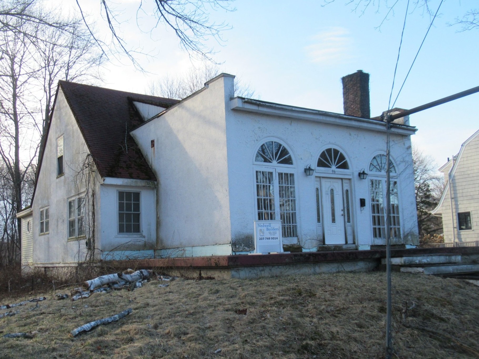
15 Cedar Street in 2019.

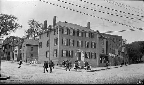
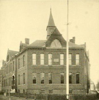
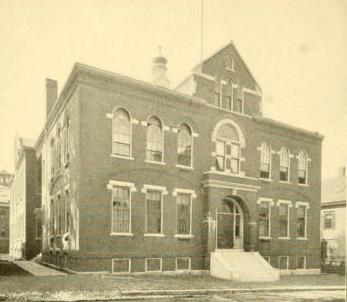
15 Cedar Street in 1924, photo courtesy Maine Memory Net.

19 Cedar Street in 2019.

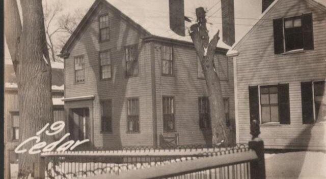
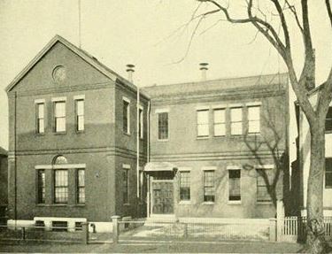
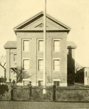
19 Cedar Street in 1924, photo courtesy Maine Memory Net..

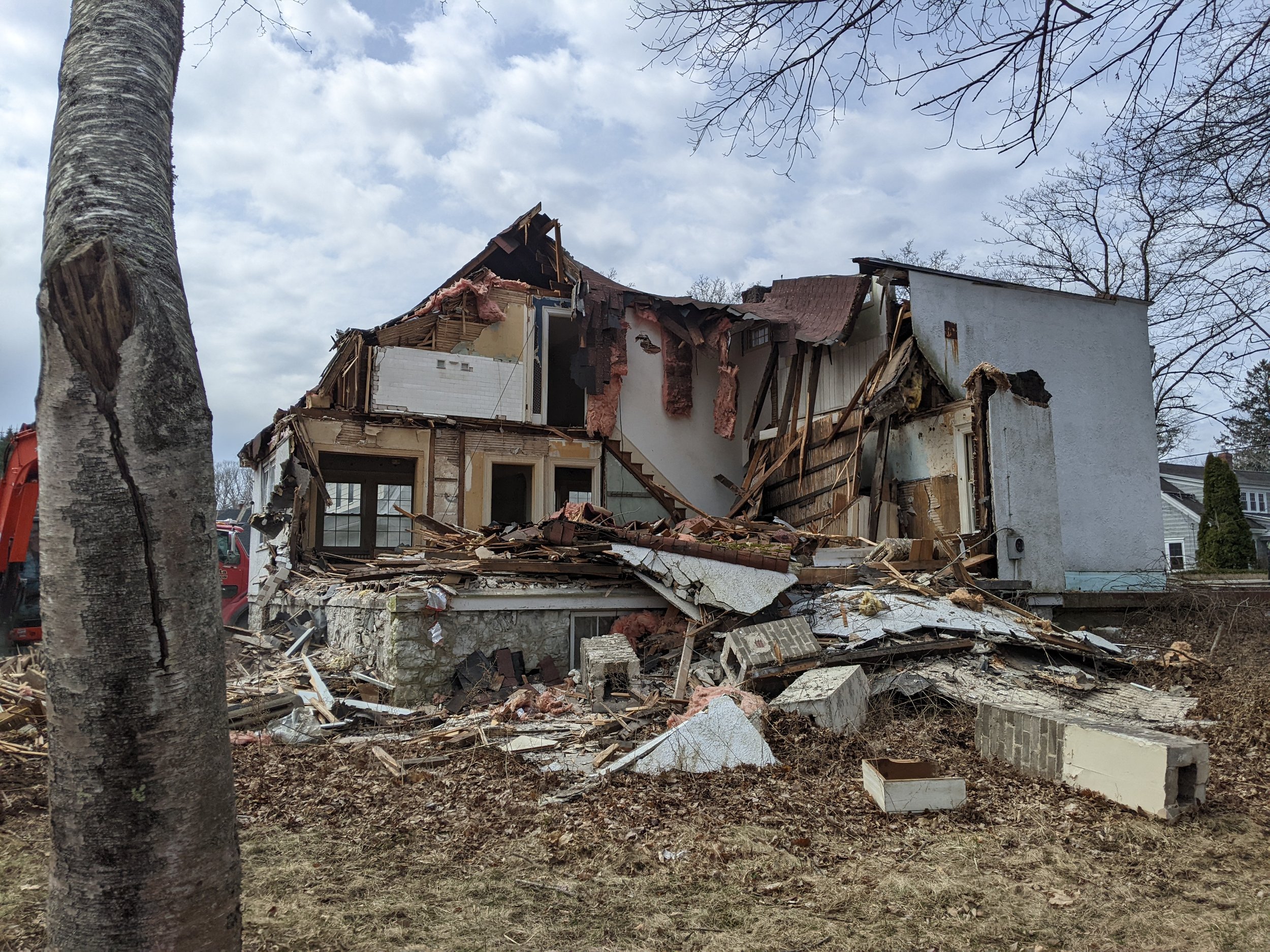
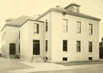
Lot encompassing 15 and 19 Cedar Street following demolition in 2021.

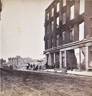
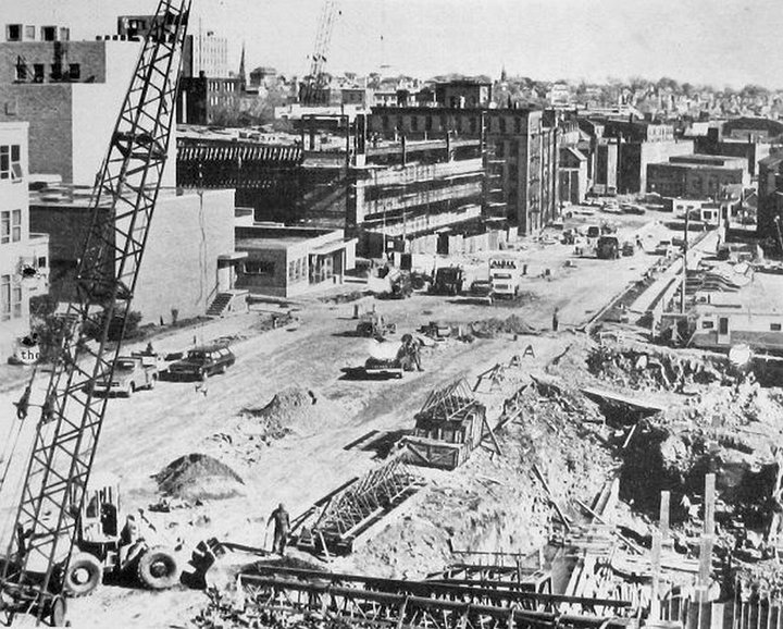
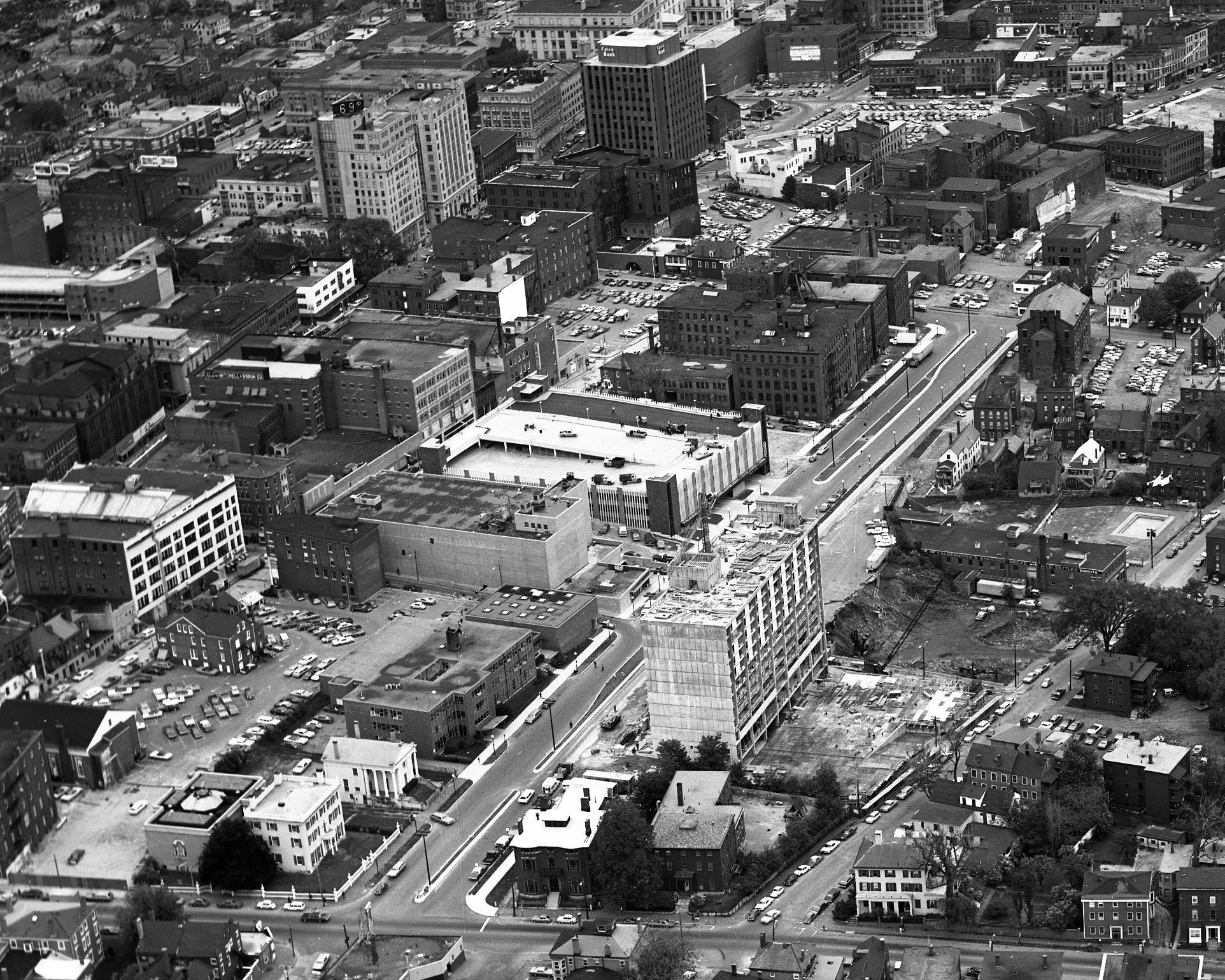
In the first half of the twentieth century, densely populated Cedar Street was home to many thriving immigrant families. Starting in 1896, Portland's small Armenian population clustered along Cedar and the surrounding streets, establishing businesses and building a close-knit community. By the 1950s, this street and many others in Bayside were targeted by the Slum Clearance and Redevelopment Authority during Portland’s urban renewal in the middle of the 20th century and many of the residences were torn down. Some of these homes were replaced with commercial structures, but many of the sites have never been developed and remain vacant or are used as parking lots to this day.

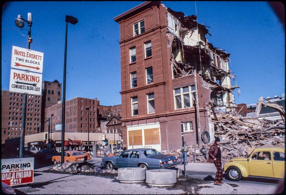
The houses at 15 and 19 Cedar Street survived the purge of urban renewal, but they fell into disrepair nonetheless, likely due to the fact that the neighborhood was made less desirable for residences by urban renewal and the fracturing of the communities that used to call this space home. By the time of their demolition, these two structures had been significantly altered, yet their walls still held a piece of the Portland's immigrant story and their demolition represents a loss to a part of city's Armenian history.

Both properties were purchased by the Boys & Girls Club (they sat behind their Cumberland Ave Clubhouse) and they were torn down in 2021.

For more information on Cedar Street, read this blog post.

 Union Station

Postcard image depicting Union Station, 1910. The brick building just visible in the background still stands.

Interior of Union Station, 1890. Image courtesy Maine Memory Net.

The tower falling during demolition of Union Station in 1961. This image galvanized the preservation movement in Portland and the action behind it led to the founding of Greater Portland Landmarks.

Built in 1888 to serve the Boston and Maine, Maine Central, and Portland and Ogdensburg Rail Roads. In response to general transportation trends and increased car ownership, Maine Central Railroad, the last holdout, ceased passenger service to Portland in 1960 and began selling off its properties. The station was torn down in 1961 to make way for a shopping center. Today all that remains of the station is the clock, housed in Congress Square Park and the shed, which now serves as the pavilion at Thompson’s Point. The demolition led to the organization of Greater Portland Landmarks and rallied public support for preserving Portland’s architectural character.

YMCA/Libby Building

Libby Building, 1978. H.H. Hay building can be seen at the far left of the photo. Image courtesy Portland Public Library, Portland Press Herald Still-Film Negatives Collection.

Shown mid-demolition, view from High Street, looking toward what is today Congress Square Park with the Eastland Hotel in the background.

Free Street Baptist Church (converted into the Chamber of Commerce by John Calvin Stevens in 1926), Women’s Christian Temperance Building, and Libby Building, ca. 1930. Image courtesy Maine Memory Network.

Former Women’s Christian Temperance Building, 1980, boasting a storefront addition , home to a tailor and a barber and supporting a massive billboard that obscured the second and third stories. Image courtesy Portland Public Library, Portland Press Herald Still-Film Negatives Collection.

Several historic buildings near the corner of High and Free Streets were removed for the expansion of the Portland Museum of Art in 1980. The most prominent of these was the original Young Men’s Christian Association Building built in 1897 directly on the corner. Later owned by Harold and Ralph Libby (the sons of J.R. Libby & Sons Department store) it became known as the Libby Building and at the time of its destruction it was a mixed use building of shops, offices and apartments.

Also torn down at the same time was the small (by comparison) building sandwiched between the Libby Building and the Chamber of Commerce building (formerly Free Street Baptist Church, recently home to the Children’s Museum & Theater of Maine). This structure was for many years owned by the Women’s Christian Temperance Union which operated it as a club house and rooming house. By the time it was demolished it was a mixed use commercial building.

 Spring Street Houses

Houses between Spring and Oak Streets representing a microcosm of Portland’s domestic architecture landscape just prior to demolition and relocation in 1971. Image courtesy Portland Public Library, Portland Press Herald Still-Film Negatives Collection.

Widening of Spring Street in process, looking east, 1971.

Spring Street, looking east, 1966.The row of houses from the corner of High and Spring Streets east to the parking lot were all lost five years later. Image courtesy Portland Public Library, Portland Press Herald Still-Film Negatives Collection.

After completion of the widening, 1972. Safford House is now on the corner of High and Spring Streets. The street has not yet been extended fully to meet Middle Street, Image courtesy Portland Public Library, Portland Press Herald Still-Film Negatives Collection.

Boasting both commercial and residential buildings Spring Street changed dramatically as part of the larger transportation plan during the city’s urban renewal. Houses of varying styles that represented a microcosm of Portland’s architectural landscape were demolished to make room for the Spring Street arterial in the early 1970s. Today only three houses remain east of High Street—Safford House, which now sits on a corner lot after its neighbor was torn down to widen the street, and the McClellan-Swett and Clapp Houses, both owned by the Portland Museum of Art. One additional building, the John J. Brown House, commonly referred to as the “Gothic House” was saved from destruction when it was relocated from its original foundation at 87 Spring Street to 387 Spring Street thanks to the efforts of Greater Portland Landmarks.

In addition to widening Spring Street, the transportation plan also extended it. As you can see in the images above, Spring Street used to terminate at Center Street. Extending Spring to connect it to Middle Street (it’s current configuration) meant the destruction of numerous commercial buildings. The cropped images from 1966 and 1972 above are courtesy of the Portland Public Library and are available to explore in high resolution.

Seeing the way things were progressing and seeking to save what they could, Greater Portland Landmarks was instrumental in establishing the Spring Street Historic District in 1970. This National Register district which extended from High Street west to Emery Street, was later absorbed into Portland’s West End Historic District.

Longfellow Birthplace

Longfellow Birthplace, 159-161 Fore Street, ca. 1920.

1928 Postcard depicting the Longfellow Birthplace, image courtesy Maine Memory Net.

Built in 1800, this handsome Federal style structure was demolished in 1955 to accommodate the expansion of a local business. Once in the heart of a residential neighborhood, by the time it was torn down the character of the neighborhood had changed. The Grand Trunk Railway complex dominated the area on

Despite being the birthplace of Henry Wadsworth Longfellow, it is not the home he grew up in. The International Longfellow Society, a passion project of Portlander Arthur C. Jackson, attempted to raise funds to save the house, but was ultimately unable to. It was only after it was torn down, followed by other iconic Portland buildings, that the preservation movement as a whole adopted it for their cause, saying “if even the house of Portland’s beloved native son could be torn down, what else might be at risk?”.

So many of the structures that were first championed by preservationists were houses lived in by famous white men, and that is a legacy that today’s preservation movement is working to rectify. Click here to learn more about how Greater Portland Landmarks is working to tell the whole story of our community, not just that of the rich and famous.

76-78 Park Street

Protesters outside 76-78 Park Street, June 20, 1988.

Protesters outside 76-78 Park Street, June 20, 1988.

Front page of the Evening Express, June 20, 1988, covering the protest and subsequent arrests at 76-78 Park St.

Built in 1857, this grand structure once faced Victoria Mansion across Park St. While its interpretation of the Italianate style was subdued compared to that of its neighbor, it was listed in the National Register of Historic Place in 1970 as a contributing building to the Spring Street Historic District. In 1988 it was owned by 75 State Street, a senior housing complex, and they deemed it unfit for their purposes so had it torn down despite having no plans to put anything else on the site. Today, where the house once stood there is a parklet for the residents of 75 State Street.

The day that the building was torn down, about 50 protesters were present, including staff and supporters of Greater Portland Landmarks. In all, seven people were arrested for their interference in the demolition. The outcry against its destruction led to the passage of a stronger demolition delay ordinance in the city.

St. Lawrence Church

St. Lawrence Church sanctuary just prior to demolition in 2008.

St. Lawrence Congregational Church, 1979. This is a rare photograph that shows the original structure in its entirety. The Parish House still remains today. Image courtesy Portland Public Library, Portland Press Herald Still-Film Negatives Collection.

Parish House as it stands today, with corrugated metal wall where the Sanctuary part of the building once connected.

Designed by Arthur Bates Jennings, St. Lawrence Church was built in 1897 to accommodate a growing congregation on Munjoy Hill. Already beginning to deteriorate, the building was listed on the National Register of Historic Places in hopes that would help save it. In 1986 the congregation dissolved and sold the building to private developers who were unable to find a use for the space and the heat was allowed to go out in the building, increasing the speed at which the structure deteriorated.

In 1993, the building was purchased with the intention that it would become a performing arts venue; four years later a friends group purchased the building. For ten years, serious efforts were made to stabilize both the sanctuary and parish house, but despite best efforts, the sanctuary was too significantly damaged and could not be made safe. In 2008, the sanctuary was torn down. The parish house has been restored and renovated as a performing arts venue. The adaptive reuse of the parish house has kept it safe in a neighborhood with rising property values and rapid development. At this time there are tentative plans to build a 400 seat venue on the site where the sanctuary was.

Old Post Office

Post Office, filling the block between Exchange and Market Streets. First National Bank building is visible on the right, ca. 1960.

Façade of the Post Office still standing after the remainder of the building had already been demolished, 1965.

The monumental Greek Revival style building was built in 1868, following the Great Fire and stood out from other Federal buildings of the same period because of both it’s Greek Revival style, and the use of marble rather than granite in its construction. The building had been used as Federal offices since the Forest Avenue Post Office opened in 1934, and by the mid 1960s, the government had decided the space would be better as parking for the Federal employees who worked in nearby offices. Greater Portland Landmarks, incorporated just one year earlier, worked with Senator Muskie’s office to prevent the demolition, and they did succeed at getting a six month demolition delay. Unfortunately, they were unable to raise the capital needed to save the building, and in 1965 it was torn down.

 Grand Trunk Railway Station

Front view, intersection of Fore & India Streets, grain elevators visible in the background, ca. 1915.

Grand Trunk Station, ca. 1915.

Interior of the Grand Trunk Station, ca. 1915.

The extent of the Grand Trunk complex in 1914, Richards Atlas of the City of Portland, 1914, plate 3.

The Grand Trunk Railway Station at the intersection of Fore and India Streets was constructed in 1903. When rail service to Montreal stopped, the station was abandoned. Having already lost the clock tower due to safety concerns in 1948, the building was demolished in 1966. The office building adjacent to the station (1 India St.) was also at risk of destruction, but has been expertly restored and is now the head office of Gorham Savings Bank.

In the heyday of the rail road in Portland, the Grand Trunk Railway had extensive properties on the waterfront. You can virtually explore the whole complex of 84-184 Fore Street using 1924 tax records at Maine Memory Network.